Return to the Therra Geography Page
Return to Gerilong - Land of Mystery
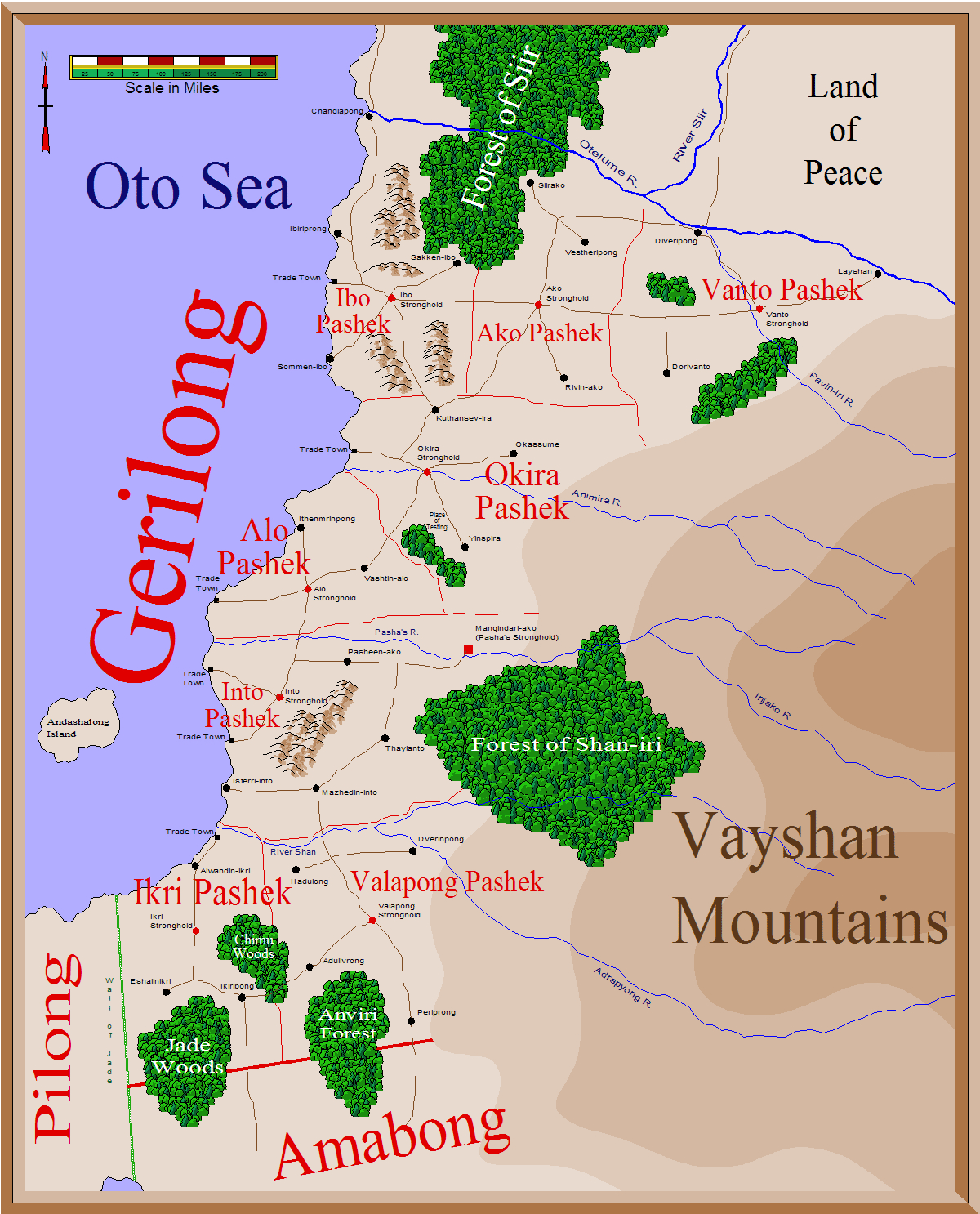
The map below presents a good overview of Gerilong, showing the major cities, trade towns, and Pashek strongholds. The boundaries of the eight Pasheks are marked, as well as major roadways, rivers, and woodlands.
Black circles represent major cities with populations of at least 10,000 residents within the city walls or the near environs.
Small black squares denote trade towns, enclaves wherein gaijin are allowed to trade and reside.
Red circles denote Pashek strongholds, the capital of each Pashek. All such strongholds are surrounded by cities with poplations of at least 10,000.
The red square denotes the Pasha's stronghold, capital city of Gerilong.
Red lines denote political boundaries, with thin lines demarking Pashek boundaries and thick lines denoting national boundaries. The boundary between Gerilong and Nygoto is not shown since it is defined by the Otelume River.
Brown lines denote major roadways. These are nowhere near the quality of the Imperial Trade Roads of the Far Coast and the Empire of Antoria, but these Gerilongi roads are somewhat maintained and well patrolled. They are neither raised nor drained and bog down in the rainy season.
The Wall of Jade is a massive magical fortification manned jointly by Gerilong and Amabong to ward off the depredations of the Pilong Shadowlands.
|
|