Return to Therra Geography Page
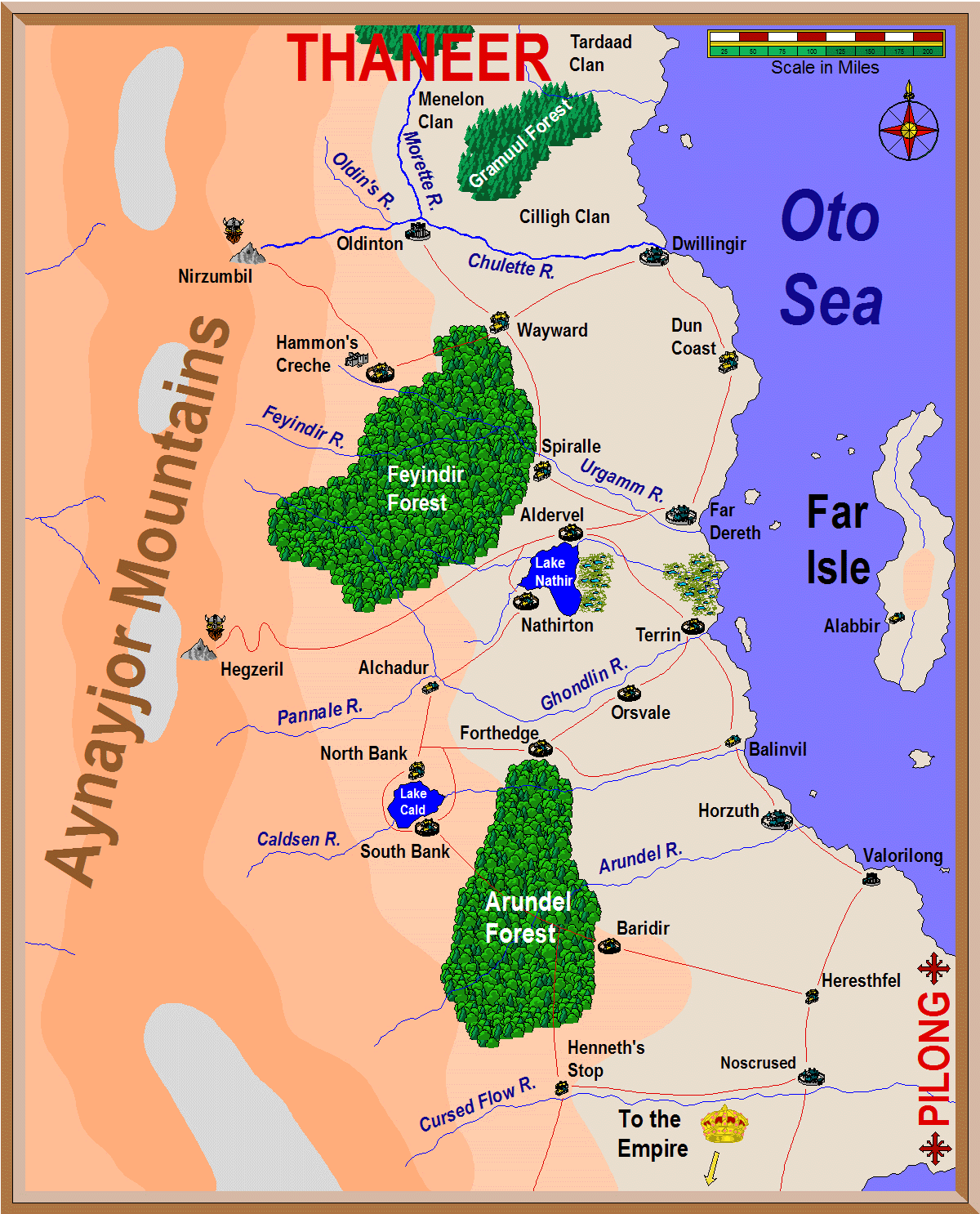
Red lines indicate Imperial roads. Large habitations indicate large towns with populations between 1500 and 5000 persons. Small habitations indicate villages or small towns with populations between 250 and 1000 permanent residents. Most of the populace of the region lives on steads or in small thorps or hamlets not indicated on the map but which tend to be clustered around the major population centres.
Thick blue lines indicate major rivers, while thin blue lines indicate lesser flows.
The contour lines outlining the Ayjayjor Mountains each represent a rise in elevation of approximately 4000 feet.
Greenish patches with small pools indicate marsh and swampland. These are named after the river or body of water from which they are formed. Thus, in the central Far Coast area the western swamp is called the Nathir Swamp and the eastern marshlands are called the Aldervel Marshes (named after the River Aldervel which is not labelled on the map but runs out from Lake Nathir past the village of Aldervel).
The towns of Nirzumbil and Hegzeril, in the Aynayjor Mountains, are dwarven cities, populations unknown.
The land of Pilong is inaccessible as a result of Morakki curses placed upon the lands in ancient times. In general, a great wall of roiling mists marks the border to mysterious Pilong.